Fani Cyclone and Global Warming 03/05/2019 – Posted in: Daily News
Fani Cyclone and Global Warming
For: Preliminary & Mains
Topics Covered: Tropical Cyclone, IMD, Cyclone’s Impacts, INCOIS
News Flash
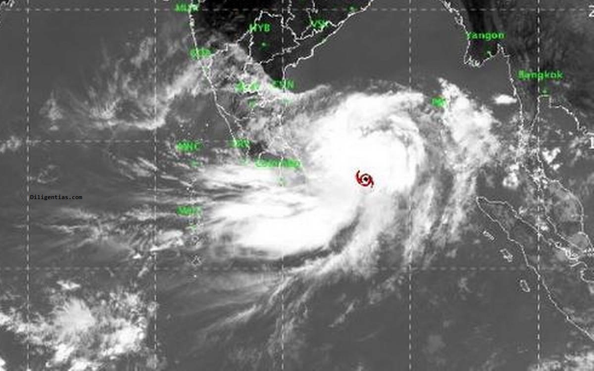
This is a cyclone that’s forming due to the warming of the Bay of Bengal.
Cyclone defined as generating maximum wind speeds of 89-117 kmph can form any time, they tend to be concentrated in November — after the monsoon — or around May, when the monsoon prepares to arrive in Kerala in June.
Tropical cyclones in the Indian neighborhood begin as ‘depressions’ or a gradual build-up of warm air and pockets of low pressure. About 35% of such formations intensify to ‘cyclones’ and only 7% intensify to ‘very severe cyclones’. About 20-30 severe tropical storms occur around the world every year.
| Tropical cyclone
Tropical cyclone, also called typhoon or hurricane, an intense circular storm that originates over warm tropical oceans and is characterized by low atmospheric pressure, high winds, and heavy rain. It draws energy from the sea surface and maintains its strength by remaining over warm water. Tropical cyclones are known by various names in different parts of the world. In the North Atlantic Ocean and the eastern North Pacific they are called hurricanes, and in the western North Pacific around the Philippines, Japan, and China the storms are referred to as typhoons. In the western South Pacific and Indian Ocean they are variously referred to as severe tropical cyclones, tropical cyclones, or simply cyclones. |
The strong winds accompanied by the torrential rains and a devastating phenomenon known as the storm surge, an elevation of the sea surface that can reach 6 metres (20 feet) above normal levels. Such a combination of high winds and water makes cyclones a serious hazard for coastal areas in tropical and subtropical areas of the world. Every year during the late summer months (July–September in the Northern Hemisphere and January–March in the Southern Hemisphere), cyclones strike regions as far apart as the Gulf Coast of North America, northwestern Australia, and eastern India and Bangladesh.
The IMD ranks cyclones on a 5-point scale with the mildest at 62-88 kmph and the strongest, a ‘super cyclonic storm’, at 221 kmph. Cyclone Fani is expected to graduate to an ‘extremely severe cyclonic storm’ and make landfall in Orissa (as a very severe cyclonic storm).
Indian National Centre for Ocean Information Services (INCOIS)
INCOIS, a research unit responsible for tracking the oceans, said that Fani’s slow progress — it is now moving at 11-18 kmph — was also a matter of worry as the longer it hovered in the ocean, the more moisture and energy it gained from the ocean and the stronger its impact along the coast.
INCOIS is an autonomous organization of the Government of India, under the Ministry of Earth Sciences, located in Hyderabad. ESSO-INCOIS was established as an autonomous body in 1999 under the Ministry of Earth Sciences (MoES) and is a unit of the Earth System Science Organization (ESSO). ESSO- INCOIS is mandated to provide the best possible ocean information and advisory services to society, industry, government agencies and the scientific community through sustained ocean observations and constant improvements through systematic and focussed research.
Probable Impacts
- Heavy rains are expected in north Andhra Pradesh and Odisha and light rains in West Bengal under the influence of the cyclone.
- Strong winds are expected in Kerala, Tamil Nadu, Puducherry and south Andhra. Fishermen have been advised to stay away from the sea.
IMD
The India Meteorological Department is an agency of the Ministry of Earth Sciences of the Government of India. It is the principal agency responsible for meteorological observations, weather forecasting and seismology.
Source: The Hindu
You can follow us on LinkedIn and for more updates related to UPSC IAS Preparation, Like our Facebook Page and subscribe our Diligent IAS Youtube Channel
Also Read Related Daily News