India- Geographical and Physical features – River, Climate 16/07/2019 – Posted in: India Inside – Tags: physical feature of india
Land and People
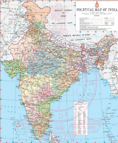
India
It stretches from the snow-capped Himalayas in the north to sun-drenched coastal villages of the south. The humid tropical forests on the south-west coast, from the fertile Brahmaputra valley on its east to the Thar desert in the west.
- India is the seventh largest country in the world and ranks second in population.
- Bounded by the Great Himalayas in the north, it stretches southwards.
- At the Tropic of Cancer, it tapers off into the Indian Ocean between the Bay of Bengal on the east and the Arabian Sea on the west.
- India lying entirely in the Northern Hemisphere.
- The mainland extends between latitudes 8°4’ and 37°6’ north, longitudes 68°7’ and 97°25’ east.
- It has a land frontier of about 15,200 km.
- The total length of the coastline of the mainland, Lakshadweep Islands and Andaman and the Nicobar Islands is 7,516.6 km.
Geographical Background
- Countries having a common border with India are Afghanistan and Pakistan to the northwest, China, Bhutan and Nepal to the north, Myanmar to the far east and Bangladesh to the east.
- Sri Lanka is separated from India by a narrow channel of sea formed by the Palk Strait and the Gulf of Mannar.
- The country can be divided into six zones mainly north, south, east, west, central and north-east zone.
- It has 29 states and seven union territories.
Physical Features
- The mainland comprises four regions, namely, the great mountain zone, plains of the Ganga and the Indus, the desert region and the southern peninsula.
- The Himalayas comprise three almost parallel ranges interspersed with large plateaus and valleys.
- The plains of the Ganga and the Indus, about 2,400 km long and 240 to 320 km broad, are formed by basins of three distinct river systems—the Indus, the Ganga, and the Brahmaputra.
- The desert region can be divided into two parts—the ‘great desert’ and the ‘little desert’.
- The great desert extends from the edge of the Rann of Kutch beyond the Luni river northward.
- The little desert extends from the Luni between Jaisalmer and Jodhpur up to the northern west.
- The Peninsular Plateau is marked off from the plains of the Ganga and the Indus by a mass of mountain and hill ranges varying from 460 to 1,220 meters in height.
- Prominent among these are the Aravali, Vindhya, Satpura, Maikala and Ajanta.
River System
The river systems of India can be classified into four groups viz., (i) Himalayan rivers, (ii) Deccan rivers, (iii) Coastal rivers and (iv) Rivers of the inland drainage basin.
- The Himalayan rivers are formed by melting snow and glaciers.
- The Deccan rivers are rain-fed. Many of these are non-perennial.
- The Coastal streams, especially on the west coast are short in length and have limited catchment areas. Most of them are non-perennial.
- The streams of the inland drainage basin of western Rajasthan are few and far apart. Most of them are of an ephemeral character.
Climate/Seasons
The climate of India may be broadly described as a tropical monsoon type. The Indian Meteorological Department (IMD) designates four official seasons:
(i) Winter, from December to early April.
(ii) Summer or pre-monsoon season, lasting from April to June.
(iii) Monsoon or rainy season, lasting from June to September.
(iv) Post-monsoon season, lasting from October to December.
The Himalayan states, being more temperate, experience two additional seasons: autumn and spring.
- India’s climate is affected by two seasonal winds—the north-east monsoon and the southwest monsoon.
- The north-east monsoon commonly known as winter monsoon blows from land to sea.
- The south-west monsoon known as summer monsoon blows from sea to land after crossing the Indian Ocean, the Arabian Sea and the Bay of Bengal.
- The south-west monsoon brings most of the rainfall during the year in the country.
Flora
- India is rich in flora.
- Available data place India in the tenth position in the world and fourth in Asia in plant diversity.
- Over 46,000 species of plants have been described by the Botanical Survey of India (BSI), Kolkata.
- The vascular flora, which forms the conspicuous vegetation cover, comprises 15,000 species.
- India can be divided into eight distinct floristic regions, namely, the western Himalayas, the eastern Himalayas, Assam, the Indus plain, the Ganga plain, the Deccan, the Malabar, and the Andamans.
- The ethnobotanical study deals with the utilization of plants and plant products by ethnic races. A scientific study of such plants has been done by BSI.
Faunal Resources
- India’s immense biological diversity encompasses ecosystems, populations, species, and genetic make-up.
- This diversity can be attributed to the vast variety in physiography and climatic situations resulting in a diversity of ecological habitats ranging from tropical, subtropical, temperate, alpine to the desert.
- According to world biogeographic classification, India represents two of the major realms (the Palearctic and Indo-Malayan) and three biomes (Tropical Humid Forests, Tropical Dry/Deciduous Forests, and Warm Deserts/Semi-Deserts).
You can follow us on LinkedIn and on Instagram (Diligent IAS) for more updates related to IAS Preparation/ Study Material, Subscribe to our Facebook Page and Youtube Channel- Diligent IAS
Also, read more topics from India Year Book