Jharkhand – Know Your States 23/05/2019 – Posted in: STATE SERIES – Tags: indian states
JHARKHAND
The region enshrouded in the hills and forests inaccessible to a large segment of people. It is the 28th State which came into being on 15 November 2000. It was split from southern Bihar and was formed into another state.
- Jharkhand is also known as “a Goldmine of Mineral Resources”.
| Capital |
|
| Date of Formation | 15th November 2000 |
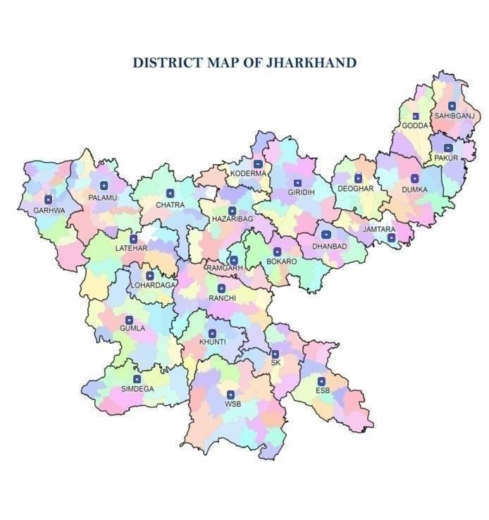
| Number of Districts | 24 |
| State Boundaries | Bihar, Uttar Pradesh, Chhattisgarh, Odisha, West Bengal |
| State Animal | Elephant |
| State Bird | Koel |
| State Tree | Sal |
| State Flower | Palash |
| Languages | Sadri, Khariya, Panchparagnia, Ho, Bangla, Hindi, Urdu, Santhali, Mundari , Kurukh, Khortha, Nagpuria, Malto, Karmali |
| Rivers | Ghagra, Damodar, Barakar, Aon, Kosi, Mayurakshi |
| Major Crops | Paddy, Maize, Wheat |
| Geographical Features |
|
| Geographical divisions | North Chotanagpur, Palamau, South Chotanagpur, Kolhan, Santhal Pargana |
| Soil | Red Soil, Micacious Soil, Sandy Soil, Black Soil, Laterite Soil |
| Minerals | Uranium, Iron Ore, Mica, Bauxite, Granite, Gold, Silver, Graphite, Magnetite, Dolomite, Fireclay, Quartz, Fieldspar, Coal (32% of India), Iron, Copper (25%of India) |
| Famous Places |
|
| Temples | Jagannath Temple, Baidyanath Temple, Rajrappa Temple, Deori Temple |
| Waterfalls | Hundru falls, Jonha fall, Dassam fall, Panch Gagh fall, Hirni fall, Sila fall |
| Dams | Konar dam, Maithon dam, Tilaiya dam |
| Wildlife Sanctuaries |
|
| National Park | Hazaribagh, Betla-Palamu |
| Dances |
|
| Festivals | Chhath Puja, Karma, Sarhul, Sohrai, Jityya Bhaiya Dooj |
| Industry |
|
| Tribes & Occupations |
|
| Institutions |
|
Historical Background
- The region came under control of the Maurya Empire and much later (17th century) was later conquered by the Mughal emperors Jahangir and Aurangzeb.
- With the Mughal decline the region came under local rulers from the Chero caste and others, before its subjugation by the British East India Company in the late 18th century.
- Under the Raj, up to 1905 the region fell within the Bengal Presidency, most of it then being transferred to the Central Provinces and Orissa Tributary States; then in 1936 the whole region was assigned to the Eastern States Agency.
- Following Indian independence in 1947, the region was divided between the new states of Madhya Pradesh, Orissa and Bihar.
Chota Nagpur Plateau
- The plateau is a part of Deccan plateau that occupies most of peninsular India.
- Chota Nagpur, actually a series of plateaus, hills, and valleys, covers nearly the entire state and consists primarily of crystalline rocks.
- The main plateaus, Hazaribag and Ranchi, are separated by the faulted sedimentary coal-bearing basin of the Damodar River.
Facts
- Ranchi is the Waterfall capital of Jharkhand.
- The highest point in Jharkhand is formed by the conical granite peak of Parasnath, which rises to 4,477 feet (1,365 metres) on the Hazaribag plateau.
- Birsa Munda (1875-1900) and Sidho and Kanho are the legendary heroes of the tribals of this state who fought against the oppressive rule of the British government.
- The soil in the Damodar valley is sandy, but heavier red soils are typical of the plateau regions.
- The natural vegetation is deciduous forest.
- Chota Nagpur is rich in sal (Shorea robusta), a valuable hardwood.
- Bamboo and bhabar (an Indian fibre grass; Ischaemum angustifolium) from Chota Nagpur supply raw materials for paper manufacture.
- The Hazaribag Wildlife Sanctuary is noted for its Bengal tigers.
- Nearly two-fifths of the population of Jharkhand consists of various indigenous peoples classified as Scheduled Tribes.
- Languages from the Indo-European family are the most widely spoken in Jharkhand.
- Hazaribagh plateau is famous for mica.
- Hundru Falls’ on Subarnarekha River.
- State occupies 1st position in coal reserve, 2nd position in Iron ore reserve, 3rd position in Copper ore reserve, 7th position in Bauxite reserve and is the sole producer of prime coking coal.
You can follow us on LinkedIn and for more updates related to UPSC IAS Preparation, Like our Facebook Page and subscribe our Diligent IAS Youtube Channel
Also read more about other Indian States