Moderate Resolution Imaging Spectroradiometer (MODIS) 15/05/2019 – Posted in: Daily News – Tags: China, Forest cover, Greening earth, Indian, MODIS, NASA
MODERATE RESOLUTION IMAGING SPECTRORADIOMETER (MODIS)
For: Preliminary & Mains
Topics covered: NASA’s Study findings, MODIS – its advantages, Cloud assistance, India & China Forest growth
News Flash
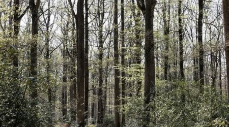
NASA satellite data reveals the Earth is greening, with China and India leading the increase in green leaf area.
- The study is based on high-resolution data gathered by a NASA sensor called Moderate Resolution Imaging Spectroradiometer (MODIS) of Earth’s surface from 2000 to 2017.
The changes emerges from China’s ambitious tree-planting programmes and intensive agriculture practised in both countries.
These two world’s most populous countries, are primarily responsible for making the Earth greener over the past two decades.
Highlights of Study
- Since 2000 the Earth’s green leaf area has increased by 5 percent, or over 5 million square kilometers.
- A net increase in leaf area of 2.3% per decade.
- That’s an area equivalent to the total of the Amazon rainforests.
- China and India account for one-third of the greening, but contain only 9 percent of the planet’s land area covered in vegetation.
- China is the source of a quarter of the planet’s increase in forest area, despite having only 6.6 percent of the world’s vegetated area.
- In China, forest conservation and expansion programs account for 42 percent of the increase. Another 32 percent come from intensive agriculture of food crops.
- In India, the greening is mostly from croplands (82%) with minor contribution from forests (4.4%).
- China and India have also greatly increased their food production through “multiple cropping” practices, where a field is replanted and crops are harvested several times each year.
- Production of grains, vegetables, fruits and more have increased by about 35 to 40 percent since 2000 to feed their large populations.

Greening earth
India’s corner
- With 2.7% of the global vegetated area, India accounts for 6.8% of the global net increase in leaf area.
- The growth being due to agriculture.
- It is as expected because most of the land cover type in India is cropland.
- Total cereal production in India increased by 26% during the same period.
- There are only a few forests in India, and that is why their contribution is small.
The Forest Survey of India’s State of Forest Report 2017 had recorded that forest cover had increased by 6,600 sq km or 0.21% since 2015.
China’s corner
- In 1978, the central government of China launched a national-level forestation project — the Three North Shelterbelt Forest Program. This project affected 30.13 million hectares.
- By the end of 2017, the forest coverage rate among the regions in the project reached 13.57 percent, compared to 5.05 percent 40 years ago. Also the forest stock volume increased by 4.96 times”.
- Under the greening project, Kubuqi Desert, seventh largest in the country, has seen one-third of its area covered by vegetation during the past three decades.
- Nationwide, China has a forest cover of 21.6 percent, and it aims to increase the number to 23.04 percent by 2020 and 26 percent by 2050.
- China has taken a series of measures, from reforesting hillsides to creating protected grassland and nature reserves.
MODIS (Moderate Resolution Imaging Spectroradiometer)
- MODIS is a key instrument aboard the Terra and Aqua satellites.
- Terra MODIS and Aqua MODIS are viewing the entire Earth’s surface every 1 to 2 days, acquiring data in 36 spectral bands, or groups of wavelengths.
- Terra’s orbit around the Earth is timed so that it passes from north to south across the equator in the morning.
- Aqua passes south to north over the equator in the afternoon.
Benefits of receiving Data
- These data will improve our understanding of global dynamics and processes occurring on the land, in the oceans, and in the lower atmosphere.
- MODIS is playing a vital role in the development of validated, global, interactive Earth system models.
- MODIS data helps to predict global change accurately enough to assist policy makers in making sound decisions concerning the protection of our environment.
MODIS’s Cloud assistance
|
Source: Indian Express
You can follow us on LinkedIn and for more updates related to UPSC IAS Preparation, Like our Facebook Page and subscribe our Diligent IAS Youtube Channel
Also Read Related Daily News