ISRO’s NavIC set to be commercialised by Antrix – Diligent IAS 04/11/2019 – Posted in: Daily News – Tags: Antrix Corporation Limited, India’s regional navigation satellite system, NavIC
NavIC set to be commercialised by Antrix – ISRO
For: Preliminary
Topics covered:
- About NavIC
- About Antrix Corporation Limited
- Why NacIC set to be commercialised?
News Flash
The ISRO and its older commercial arm Antrix Corporation Ltd. are poised to commercialise India’s regional navigation satellite system, NavIC.
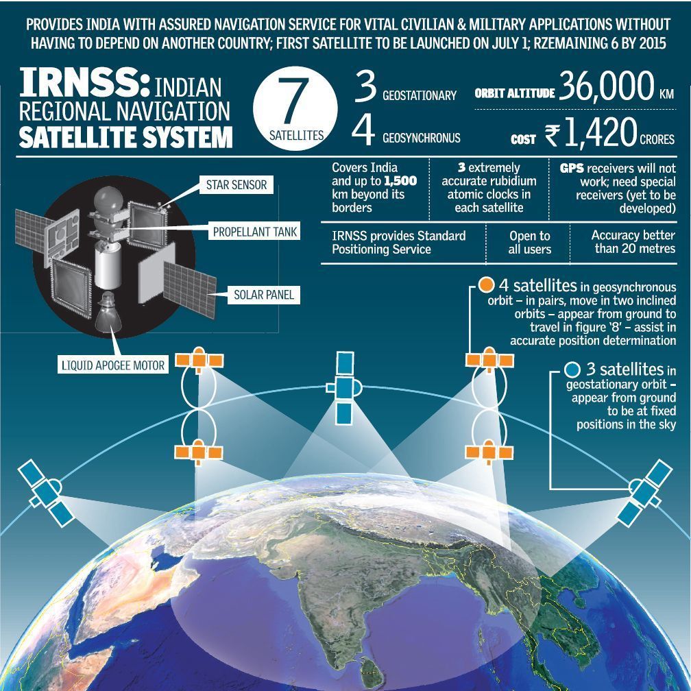
Navigation in Indian Constellation (NavIC)
- NavIC is the Indian system of eight satellites that is aimed at telling the business and individual users where they are, or how their products and services are moving.
- The indigenous positioning or location-based service (LBS) works just like the established and popular U.S. Global Positioning System or GPS but within a 1,500-km radius over the sub-continent.
Antrix Corporation Limited (ACL), Bengaluru
ACL is a wholly-owned Government of India Company under the administrative control of the Department of Space. It was incorporated as a private limited company owned by the government of India in September 1992 as a Marketing arm of ISRO for promotion and commercial exploitation of space products, technical consultancy services and transfer of technologies developed by ISRO.
Antrix is also engaged in providing Space products and services to international customers worldwide.
What?
- ACL is currently identifying suitable device manufacturers on the one side and comprehensive integrators of NavIC-based systems (SIs) on the other side.
- Antrix recently floating two separate tenders to identify industries that can develop dedicated NavIC-based hardware and systems.
Recent developments
In mid-October, ISRO announced that Qualcomm Technologies (producer of semiconductor chips) had developed and tested NavIC-friendly chipsets across its user bases and that it would add NavIC to them. Apart from GPS, its chips can work with the global navigation satellite systems of Europe (Galileo), Russia (GLONASS) and China (Beidou). This support would be available for original equipment manufacturers (OEMs) from November.
NavIC was also certified by the 3GPP (The 3rd Generation Partnership Project), a global body for coordinating mobile telephony standards (Telecommunications Standards Development Society, India- TSDSI). The specifications will be available in March 2020 and would be adopted as a national standard.
Potential applications of the regional navigation system:
- Terrestrial, aerial and marine navigation
- Disaster management
- Vehicle tracking and fleet management
- Integration with mobile phones
- Precise timing (as for ATMs and power grids)
- Mapping and geodetic data capture
- As terrestrial navigation aid for hikers and travellers
- For visual and voice navigation for drivers.
Source: The Hindu
READ MORE DAILY NEWS
- Government releases new maps of UTs of J&K, Ladakh
- Exercise – Dustlik-2019
- India’s labour productivity growth
- World’s first artificial intelligence university
You are on the Best Online IAS preparation platform. You are learning under experts.
We are present on Facebook- Diligent IAS, LinkedIn- Diligent IAS, YouTube- Diligent IAS, Instagram- Diligent IAS. Get in touch with us.